|
| at: |
Coleman River Scenic Area |
Data from David Muse
 show on map
 animate
Trail users:


Elevation Profile
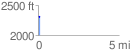
 0.106344 mi
 4.68 ft
 10.41 ft
 -5.73 ft
 1.85 %
GPX Downloads: Track Route
![]()
|
| at: |
Coleman River Scenic Area |
show on map
animate
0.106344 mi
4.68 ft
10.41 ft
-5.73 ft
1.85 %