| at: |
Tannehill Ironworks Historical State Park |
Data from Positive Flow
 show on map
 animate
Trail users:


Elevation Profile
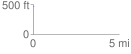
 0.034578 mi
 9.36 ft
 0.00 ft
 9.36 ft
 5.12 %
GPX Downloads: Track Route
![]()
| at: |
Tannehill Ironworks Historical State Park |
show on map
animate
0.034578 mi
9.36 ft
0.00 ft
9.36 ft
5.12 %