| at: |
North Mills River Recreation Area |
Data from Positive Flow
 show on map
 animate
Trail users:


Elevation Profile
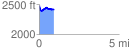
 0.922531 mi
 95.87 ft
 155.17 ft
 -59.30 ft
 3.19 %
GPX Downloads: Track Route
![]()
| at: |
North Mills River Recreation Area |
show on map
animate
0.922531 mi
95.87 ft
155.17 ft
-59.30 ft
3.19 %