| at: |
North Mills River Recreation Area |
Data from Positive Flow
 show on map
 animate
Trail users:


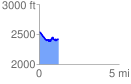
Elevation Profile
 1.207207 mi
 132.10 ft
 265.70 ft
 -133.60 ft
 4.17 %
GPX Downloads: Track Route
![]()
| at: |
North Mills River Recreation Area |
show on map
animate
1.207207 mi
132.10 ft
265.70 ft
-133.60 ft
4.17 %