|
| at: |
Warwoman WMA |
Data from David Muse
 show on map
 animate
The signs on this road mark it as 155A, but the USFS GIS data calls it 155E.
Trail users:


Elevation Profile
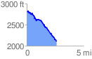
 2.667760 mi
 356.84 ft
 1088.44 ft
 -731.60 ft
 7.73 %
GPX Downloads: Track Route