| at: |
LBJ National Grassland |
Data from USFS GIS
 show on map
 animate
Trail users:


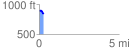
Elevation Profile
 0.261908 mi
 10.16 ft
 59.17 ft
 -49.01 ft
 4.28 %
GPX Downloads: Track Route
![]()
| at: |
LBJ National Grassland |
show on map
animate
0.261908 mi
10.16 ft
59.17 ft
-49.01 ft
4.28 %