|
| at: |
LBJ National Grassland |
Data from USFS GIS
 show on map
 animate
Trail users:


Elevation Profile
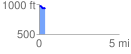
 0.371157 mi
 14.53 ft
 48.62 ft
 -34.08 ft
 2.48 %
GPX Downloads: Track Route
![]()
|
| at: |
LBJ National Grassland |
show on map
animate
0.371157 mi
14.53 ft
48.62 ft
-34.08 ft
2.48 %