| at: |
LBJ National Grassland |
Data from USFS GIS
 show on map
 animate
Trail users:


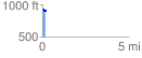
Elevation Profile
 0.190493 mi
 11.38 ft
 39.13 ft
 -27.76 ft
 3.89 %
GPX Downloads: Track Route
![]()
| at: |
LBJ National Grassland |
show on map
animate
0.190493 mi
11.38 ft
39.13 ft
-27.76 ft
3.89 %