| at: |
LBJ National Grassland |
Data from USFS GIS
 show on map
 animate
Trail users:


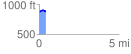
Elevation Profile
 0.404231 mi
 35.14 ft
 23.37 ft
 11.77 ft
 1.65 %
GPX Downloads: Track Route
![]()
| at: |
LBJ National Grassland |
show on map
animate
0.404231 mi
35.14 ft
23.37 ft
11.77 ft
1.65 %