| at: |
LBJ National Grassland |
Data from USFS GIS
 show on map
 animate
Trail users:


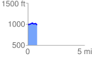
Elevation Profile
 0.835734 mi
 53.86 ft
 53.62 ft
 0.24 ft
 1.22 %
GPX Downloads: Track Route
![]()
| at: |
LBJ National Grassland |
show on map
animate
0.835734 mi
53.86 ft
53.62 ft
0.24 ft
1.22 %