| at: |
Caddo National Grassland Near Bonham |
Data from USFS GIS
 show on map
 animate
Trail users:


Elevation Profile
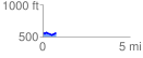
 0.785226 mi
 56.47 ft
 57.47 ft
 -1.00 ft
 1.39 %
GPX Downloads: Track Route
![]()
| at: |
Caddo National Grassland Near Bonham |
show on map
animate
0.785226 mi
56.47 ft
57.47 ft
-1.00 ft
1.39 %