| at: |
Angelina National Forest |
Data from USFS GIS
 show on map
 animate
Trail users:


Elevation Profile
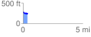
 0.388854 mi
 41.49 ft
 58.18 ft
 -16.69 ft
 2.83 %
GPX Downloads: Track Route
![]()
| at: |
Angelina National Forest |
show on map
animate
0.388854 mi
41.49 ft
58.18 ft
-16.69 ft
2.83 %