| at: |
Angelina National Forest |
Data from USFS GIS
 show on map
 animate
Trail users:


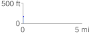
Elevation Profile
 0.083976 mi
 16.90 ft
 0.73 ft
 16.18 ft
 3.81 %
GPX Downloads: Track Route
![]()
| at: |
Angelina National Forest |
show on map
animate
0.083976 mi
16.90 ft
0.73 ft
16.18 ft
3.81 %