| at: |
Angelina National Forest |
Data from USFS GIS
 show on map
 animate
Trail users:


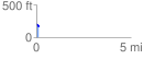
Elevation Profile
 0.143467 mi
 3.26 ft
 42.73 ft
 -39.47 ft
 5.64 %
GPX Downloads: Track Route
![]()
| at: |
Angelina National Forest |
show on map
animate
0.143467 mi
3.26 ft
42.73 ft
-39.47 ft
5.64 %