|
| at: |
Angelina National Forest |
Data from USFS GIS
 show on map
 animate
Trail users:


Elevation Profile
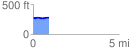
 0.933792 mi
 38.87 ft
 27.31 ft
 11.56 ft
 0.79 %
GPX Downloads: Track Route
![]()
|
| at: |
Angelina National Forest |
show on map
animate
0.933792 mi
38.87 ft
27.31 ft
11.56 ft
0.79 %