| at: |
Angelina National Forest |
Data from USFS GIS
 show on map
 animate
Trail users:


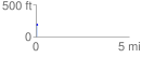
Elevation Profile
 0.081056 mi
 1.15 ft
 20.79 ft
 -19.64 ft
 4.86 %
GPX Downloads: Track Route
![]()
| at: |
Angelina National Forest |
show on map
animate
0.081056 mi
1.15 ft
20.79 ft
-19.64 ft
4.86 %