|
| at: |
Angelina National Forest |
Data from USFS GIS
 show on map
 animate
Trail users:


Elevation Profile
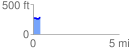
 0.407838 mi
 36.88 ft
 18.41 ft
 18.47 ft
 1.71 %
GPX Downloads: Track Route
![]()
|
| at: |
Angelina National Forest |
show on map
animate
0.407838 mi
36.88 ft
18.41 ft
18.47 ft
1.71 %