| at: |
Angelina National Forest |
Data from USFS GIS
 show on map
 animate
Trail users:


Elevation Profile
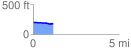
 1.182649 mi
 6.60 ft
 32.38 ft
 -25.78 ft
 0.52 %
GPX Downloads: Track Route
![]()
| at: |
Angelina National Forest |
show on map
animate
1.182649 mi
6.60 ft
32.38 ft
-25.78 ft
0.52 %