| at: |
Angelina National Forest |
Data from USFS GIS
 show on map
 animate
Trail users:


Elevation Profile
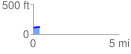
 0.391649 mi
 10.79 ft
 6.29 ft
 4.50 ft
 0.52 %
GPX Downloads: Track Route
![]()
| at: |
Angelina National Forest |
show on map
animate
0.391649 mi
10.79 ft
6.29 ft
4.50 ft
0.52 %