| at: |
Angelina National Forest |
Data from USFS GIS
 show on map
 animate
Trail users:


Elevation Profile
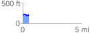
 0.522423 mi
 40.55 ft
 30.71 ft
 9.84 ft
 1.47 %
GPX Downloads: Track Route
![]()
| at: |
Angelina National Forest |
show on map
animate
0.522423 mi
40.55 ft
30.71 ft
9.84 ft
1.47 %