| at: |
Angelina National Forest |
Data from USFS GIS
 show on map
 animate
Trail users:


Elevation Profile
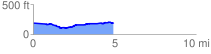
 5.008881 mi
 155.19 ft
 157.61 ft
 -2.42 ft
 0.60 %
GPX Downloads: Track Route
![]()
| at: |
Angelina National Forest |
show on map
animate
5.008881 mi
155.19 ft
157.61 ft
-2.42 ft
0.60 %