| at: |
Sabine National Forest |
Data from USFS GIS
 show on map
 animate
Trail users:


Elevation Profile
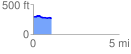
 1.076459 mi
 24.56 ft
 50.96 ft
 -26.40 ft
 0.90 %
GPX Downloads: Track Route
![]()
| at: |
Sabine National Forest |
show on map
animate
1.076459 mi
24.56 ft
50.96 ft
-26.40 ft
0.90 %