|
| at: |
Sabine National Forest |
Data from USFS GIS
 show on map
 animate
Trail users:


Elevation Profile
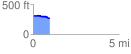
 0.951482 mi
 15.02 ft
 58.74 ft
 -43.72 ft
 1.17 %
GPX Downloads: Track Route
![]()
|
| at: |
Sabine National Forest |
show on map
animate
0.951482 mi
15.02 ft
58.74 ft
-43.72 ft
1.17 %