|
| at: |
Sabine National Forest |
Data from USFS GIS
 show on map
 animate
Trail users:


Elevation Profile
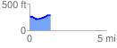
 1.362523 mi
 98.05 ft
 63.91 ft
 34.14 ft
 1.36 %
GPX Downloads: Track Route
![]()
|
| at: |
Sabine National Forest |
show on map
animate
1.362523 mi
98.05 ft
63.91 ft
34.14 ft
1.36 %