|
| at: |
Sabine National Forest |
Data from USFS GIS
 show on map
 animate
Trail users:


Elevation Profile
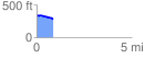
 0.872466 mi
 11.44 ft
 74.26 ft
 -62.82 ft
 1.61 %
GPX Downloads: Track Route
![]()
|
| at: |
Sabine National Forest |
show on map
animate
0.872466 mi
11.44 ft
74.26 ft
-62.82 ft
1.61 %