|
| at: |
Sabine National Forest |
Data from USFS GIS
 show on map
 animate
Trail users:


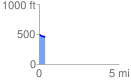
Elevation Profile
 0.369694 mi
 2.07 ft
 32.96 ft
 -30.89 ft
 1.69 %
GPX Downloads: Track Route
![]()
|
| at: |
Sabine National Forest |
show on map
animate
0.369694 mi
2.07 ft
32.96 ft
-30.89 ft
1.69 %