| at: |
Sabine National Forest |
Data from USFS GIS
 show on map
 animate
Trail users:


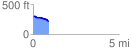
Elevation Profile
 0.919741 mi
 19.38 ft
 91.59 ft
 -72.21 ft
 1.89 %
GPX Downloads: Track Route
![]()
| at: |
Sabine National Forest |
show on map
animate
0.919741 mi
19.38 ft
91.59 ft
-72.21 ft
1.89 %