|
| at: |
Sabine National Forest |
Data from USFS GIS
 show on map
 animate
Trail users:


Elevation Profile
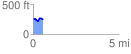
 0.567684 mi
 53.33 ft
 67.71 ft
 -14.39 ft
 2.26 %
GPX Downloads: Track Route
![]()
|
| at: |
Sabine National Forest |
show on map
animate
0.567684 mi
53.33 ft
67.71 ft
-14.39 ft
2.26 %