| at: |
Sabine National Forest |
Data from USFS GIS
 show on map
 animate
Trail users:


Elevation Profile
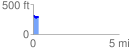
 0.305001 mi
 39.31 ft
 59.86 ft
 -20.55 ft
 3.72 %
GPX Downloads: Track Route
![]()
| at: |
Sabine National Forest |
show on map
animate
0.305001 mi
39.31 ft
59.86 ft
-20.55 ft
3.72 %