|
| at: |
Sabine National Forest |
Data from USFS GIS
 show on map
 animate
Trail users:


Elevation Profile
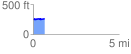
 0.672171 mi
 27.53 ft
 12.54 ft
 14.99 ft
 0.78 %
GPX Downloads: Track Route
![]()
|
| at: |
Sabine National Forest |
show on map
animate
0.672171 mi
27.53 ft
12.54 ft
14.99 ft
0.78 %