|
| at: |
Sabine National Forest |
Data from USFS GIS
 show on map
 animate
Trail users:


Elevation Profile
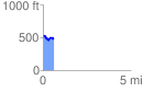
 0.610785 mi
 65.10 ft
 93.44 ft
 -28.34 ft
 2.90 %
GPX Downloads: Track Route
![]()
|
| at: |
Sabine National Forest |
show on map
animate
0.610785 mi
65.10 ft
93.44 ft
-28.34 ft
2.90 %