| at: |
Sabine National Forest |
Data from USFS GIS
 show on map
 animate
Trail users:


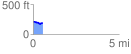
Elevation Profile
 0.583606 mi
 18.95 ft
 49.04 ft
 -30.09 ft
 1.59 %
GPX Downloads: Track Route
![]()
| at: |
Sabine National Forest |
show on map
animate
0.583606 mi
18.95 ft
49.04 ft
-30.09 ft
1.59 %