| at: |
Sabine National Forest |
Data from USFS GIS
 show on map
 animate
Trail users:


Elevation Profile
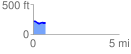
 0.718196 mi
 18.82 ft
 50.15 ft
 -31.33 ft
 1.32 %
GPX Downloads: Track Route
![]()
| at: |
Sabine National Forest |
show on map
animate
0.718196 mi
18.82 ft
50.15 ft
-31.33 ft
1.32 %