| at: |
Sabine National Forest |
Data from USFS GIS
 show on map
 animate
Trail users:


Elevation Profile
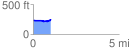
 1.043166 mi
 56.44 ft
 42.74 ft
 13.70 ft
 1.02 %
GPX Downloads: Track Route
![]()
| at: |
Sabine National Forest |
show on map
animate
1.043166 mi
56.44 ft
42.74 ft
13.70 ft
1.02 %