| at: |
Sabine National Forest |
Data from USFS GIS
 show on map
 animate
Trail users:


Elevation Profile
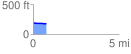
 0.771327 mi
 3.19 ft
 15.94 ft
 -12.75 ft
 0.39 %
GPX Downloads: Track Route
![]()
| at: |
Sabine National Forest |
show on map
animate
0.771327 mi
3.19 ft
15.94 ft
-12.75 ft
0.39 %