| at: |
Sam Houston National Forest |
Data from USFS GIS
 show on map
 animate
Trail users:


Elevation Profile
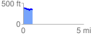
 0.792046 mi
 47.02 ft
 90.92 ft
 -43.90 ft
 2.17 %
GPX Downloads: Track Route
![]()
| at: |
Sam Houston National Forest |
show on map
animate
0.792046 mi
47.02 ft
90.92 ft
-43.90 ft
2.17 %