| at: |
Sam Houston National Forest |
Data from USFS GIS
 show on map
 animate
Trail users:


Elevation Profile
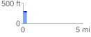
 0.300538 mi
 4.93 ft
 14.07 ft
 -9.14 ft
 0.89 %
GPX Downloads: Track Route
![]()
| at: |
Sam Houston National Forest |
show on map
animate
0.300538 mi
4.93 ft
14.07 ft
-9.14 ft
0.89 %