|
| at: |
Blue Ridge WMA |
Data from David Muse
 show on map
 animate
This road is now unmarked, blocked and closed to vehicular traffic. It was formerly marked FS28C in the field and on USGS maps, but FS28E in USGS GIS data.
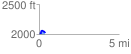
Trail users:Elevation Profile
 0.388973 mi
 72.86 ft
 55.36 ft
 17.50 ft
 3.55 %
GPX Downloads: Track Route