| at: |
Clayton County International Park |
Data from David Muse
 show on map
 animate
Trail users:


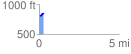
Elevation Profile
 0.298524 mi
 40.38 ft
 2.49 ft
 37.90 ft
 2.56 %
GPX Downloads: Track Route
![]()
| at: |
Clayton County International Park |
show on map
animate
0.298524 mi
40.38 ft
2.49 ft
37.90 ft
2.56 %