| at: |
Clayton County International Park |
Data from David Muse
 show on map
 animate
Trail users:


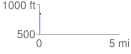
Elevation Profile
 0.075096 mi
 4.81 ft
 5.57 ft
 -0.77 ft
 1.41 %
GPX Downloads: Track Route
![]()
| at: |
Clayton County International Park |
show on map
animate
0.075096 mi
4.81 ft
5.57 ft
-0.77 ft
1.41 %