| at: |
Sumter National Forest - Long Cane District |
Data from USFS GIS
 show on map
 animate
Trail users:

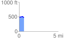
Elevation Profile
 0.647938 mi
 21.92 ft
 42.49 ft
 -20.57 ft
 1.24 %
GPX Downloads: Track Route
![]()
| at: |
Sumter National Forest - Long Cane District |
show on map
animate
0.647938 mi
21.92 ft
42.49 ft
-20.57 ft
1.24 %