|
| at: |
Forks Area Trail System Sumter National Forest - Long Cane District |
Data from USFS GIS
 show on map
 animate
Trail users:


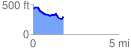
Elevation Profile
 1.775833 mi
 130.02 ft
 261.09 ft
 -131.07 ft
 2.78 %
GPX Downloads: Track Route