| at: |
Settles Bridge |
Data from David Muse
 show on map
 animate
Trail users:

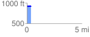
Elevation Profile
 0.375553 mi
 18.72 ft
 26.55 ft
 -7.83 ft
 1.34 %
GPX Downloads: Track Route
![]()
| at: |
Settles Bridge |
show on map
animate
0.375553 mi
18.72 ft
26.55 ft
-7.83 ft
1.34 %