| at: |
Clemson Experimental Forest |
Data from Positive Flow
 show on map
 animate
Trail users:


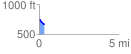
Elevation Profile
 0.313471 mi
 0.00 ft
 82.98 ft
 -82.98 ft
 5.01 %
GPX Downloads: Track Route
![]()
| at: |
Clemson Experimental Forest |
show on map
animate
0.313471 mi
0.00 ft
82.98 ft
-82.98 ft
5.01 %