| at: |
Suwanee Creek Greenway |
Data from Positive Flow
 show on map
 animate
Trail users:


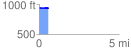
Elevation Profile
 0.571229 mi
 5.41 ft
 21.74 ft
 -16.33 ft
 0.72 %
GPX Downloads: Track Route
![]()
| at: |
Suwanee Creek Greenway |
show on map
animate
0.571229 mi
5.41 ft
21.74 ft
-16.33 ft
0.72 %