| at: |
Dry Creek |
Data from David Muse
 show on map
 animate
Trail users:


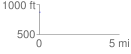
Elevation Profile
 0.014833 mi
 18.58 ft
 0.00 ft
 18.58 ft
 23.72 %
GPX Downloads: Track Route
![]()
| at: |
Dry Creek |
show on map
animate
0.014833 mi
18.58 ft
0.00 ft
18.58 ft
23.72 %