| at: |
Croom Mountain Bike Trails |
Data from Karlos Bernart
 show on map
 animate
Trail users:


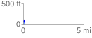
Elevation Profile
 0.146584 mi
 90.71 ft
 69.44 ft
 21.27 ft
 11.72 %
GPX Downloads: Track Route
![]()
| at: |
Croom Mountain Bike Trails |
show on map
animate
0.146584 mi
90.71 ft
69.44 ft
21.27 ft
11.72 %