| at: |
Croom Mountain Bike Trails |
Data from David Muse
 show on map
 animate
Trail users:


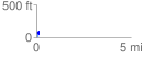
Elevation Profile
 0.122439 mi
 72.05 ft
 58.64 ft
 13.42 ft
 11.15 %
GPX Downloads: Track Route
![]()
| at: |
Croom Mountain Bike Trails |
show on map
animate
0.122439 mi
72.05 ft
58.64 ft
13.42 ft
11.15 %