| at: |
Bent Creek |
Data from David Muse
 show on map
 animate
Trail users:


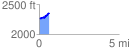
Elevation Profile
 0.633343 mi
 133.62 ft
 32.43 ft
 101.19 ft
 4.00 %
GPX Downloads: Track Route
![]()
| at: |
Bent Creek |
show on map
animate
0.633343 mi
133.62 ft
32.43 ft
101.19 ft
4.00 %