| at: |
Bent Creek |
Data from Positive Flow
 show on map
 animate
Trail users:


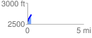
Elevation Profile
 0.345121 mi
 179.33 ft
 2.55 ft
 176.79 ft
 9.84 %
GPX Downloads: Track Route
![]()
| at: |
Bent Creek |
show on map
animate
0.345121 mi
179.33 ft
2.55 ft
176.79 ft
9.84 %